TravelTalkOnline
Scary one
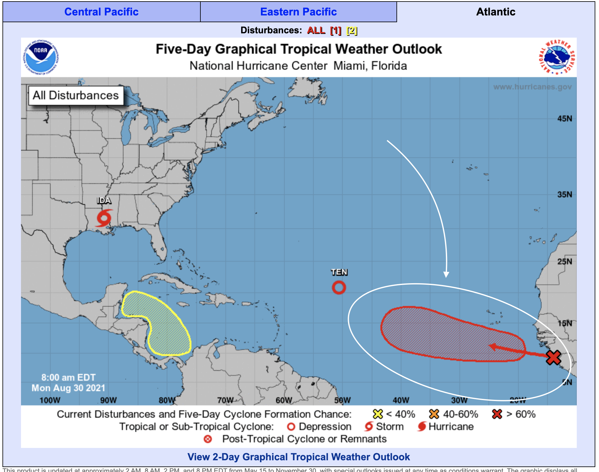
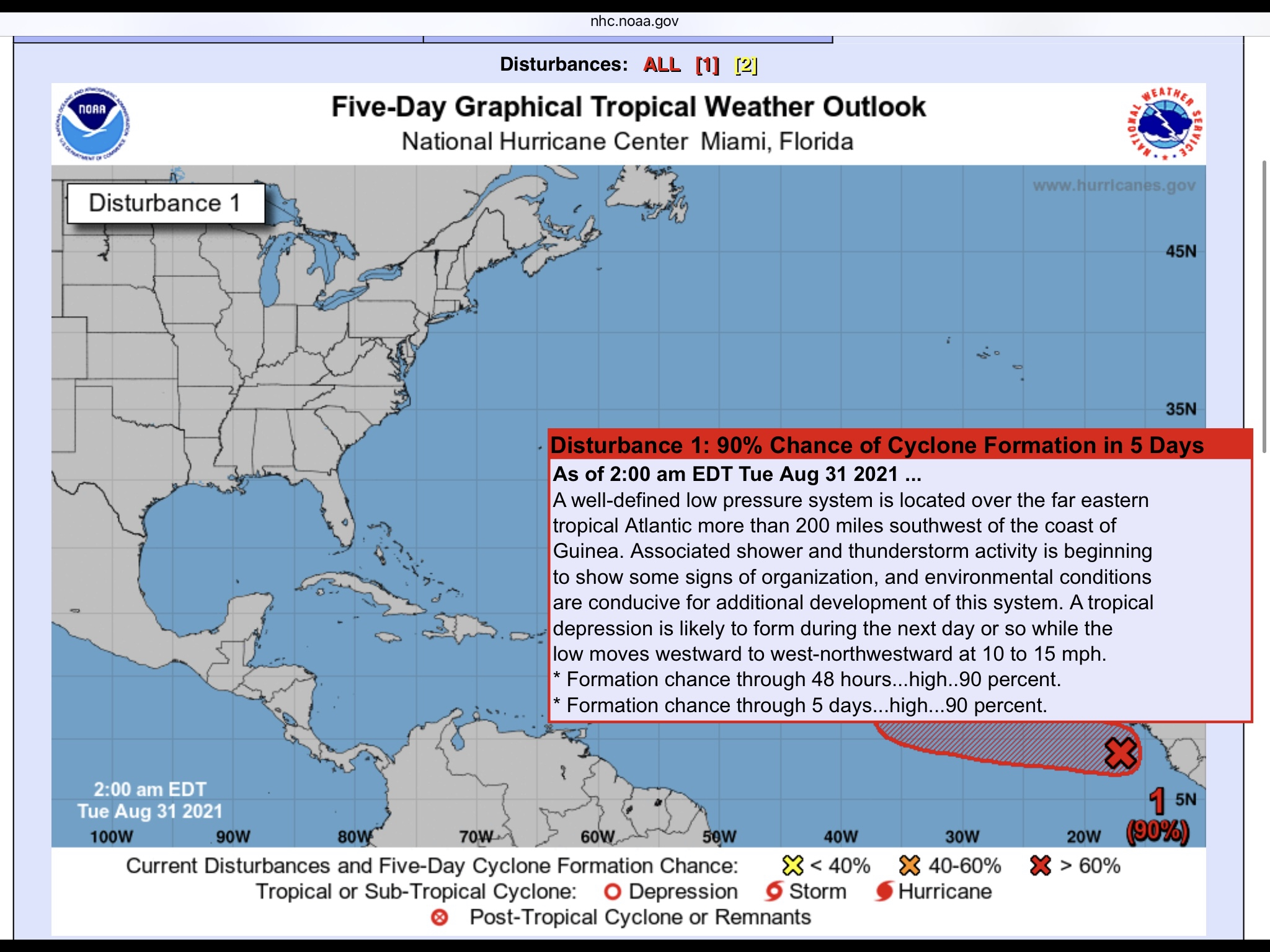
A big scary one brewing off the coast of Africa right now. Definitely worth keeping an eye on...

Posted By: sxmmartini
Re: Scary one - 08/30/2021 02:42 PM
A poll taken shows most bet it will be named Larry on September 3rd.
Posted By: Manpot
Re: Scary one - 08/30/2021 06:05 PM
This one is making me nervous..
Posted By: bigbone
Re: Scary one - 08/30/2021 08:25 PM
Maybe dangerous
Posted By: Kmon
Re: Scary one - 08/31/2021 12:24 AM
This is a tweet from renowned weatherman Joe Bastardi 6 hrs ago. Hope he is right!
"Kate another storm that will stay far away A MAJOR Atlantic hurricane will develop next week and stay out at sea."
Posted By: LocalSailor
Re: Scary one - 08/31/2021 01:58 AM
Posted By: LocalSailor
Re: Scary one - 08/31/2021 03:04 AM
Forecaster Carette----
quote
ANALYSIS
What bears watching is how much the disturbance develops and strengthens in the coming days. The stronger it becomes in the next five to seven days, the more likely it will be pulled northward and into the open Atlantic. On the other hand, if we see a disturbance that takes its time to develop, it becomes more likely that it will miss the weakness in the high-pressure ridge and track westward instead.
This tropical wave looks quite large in overall size and larger disturbances sometimes take a lot longer to organize and develop than smaller ones do. It is very possible that the forecast models are developing this disturbance too quickly, and in the end, we may see much slower development, which could steer the system a lot further west when compared to the model’s suggested track.
It is not a given that this system will end up curving into the open Atlantic and therefore should be closely watched over the next few days. Two areas to pay particularly close attention to: first is the far northern Leeward Islands for late this weekend into early next week; second is Bermuda where this disturbance needs to be watched for the middle and end of next week.
Posted By: sxmmartini
Re: Scary one - 08/31/2021 11:17 AM
Reminds me of Hurricane Irma when all the models had it recurve and go above the islands.

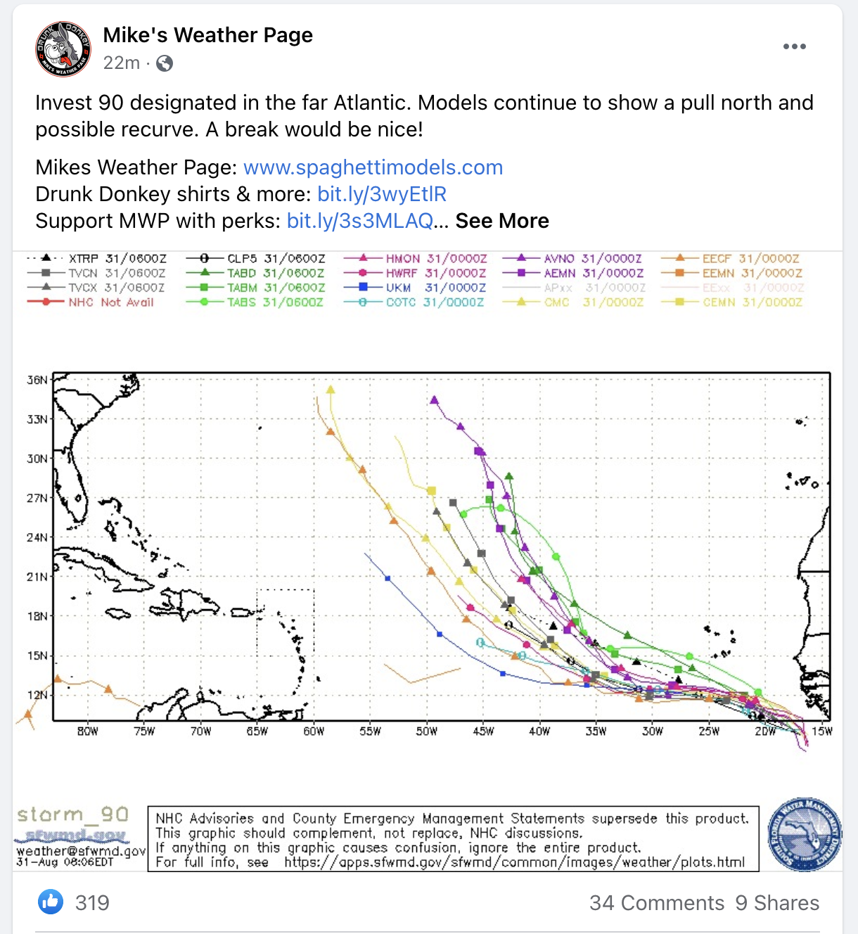
Great insight above from both. Here is what some current spaghetti models are showing from Mike's Weather Page... Let's hope it stays that way!

Posted By: GeorgeC1
Re: Scary one - 08/31/2021 12:51 PM
I like Mike! Mike for president!
Seems to be trending to head North out to the Atlantic but definitely still keeping an eye on this one.
Posted By: Manpot
Re: Scary one - 08/31/2021 09:38 PM
Surf's up Apple Bay, CGB and Josiahs'..start waxing!
Posted By: Carol_Hill
Re: Scary one - 09/01/2021 12:37 AM
As of now, it's TD 12 and supposedly going out to sea.. Hopefully.
Posted By: Manpot
Re: Scary one - 09/01/2021 02:51 PM
Good morning tropical storm Larry..now trending a little more west and less north. Lets hope it starts its northward curve and then wish the best for Bermuda!
Posted By: LocalSailor
Re: Scary one - 09/02/2021 08:58 AM
Thursday 5am forecast LARRY ---- NHC
FORECAST POSITIONS AND MAX WINDS
INIT 02/0900Z 13.0N 32.3W 65 KT 75 MPH
12H 02/1800Z 13.4N 34.7W 75 KT 85 MPH
24H 03/0600Z 14.0N 37.9W 85 KT 100 MPH
36H 03/1800Z 14.8N 40.9W 95 KT 110 MPH
48H 04/0600Z 15.8N 43.6W 100 KT 115 MPH
60H 04/1800Z 16.9N 46.1W 105 KT 120 MPH
72H 05/0600Z 18.3N 48.3W 110 KT 125 MPH
96H 06/0600Z 20.9N 52.1W 115 KT 130 MPH
120H 07/0600Z 23.8N 55.4W 110 KT 125 MPH
$$
Forecaster Pasch
Posted By: Carol_Hill
Re: Scary one - 09/02/2021 01:14 PM
Position and track definitely looks promising for the BVI..
Posted By: sleepychef
Re: Scary one - 09/02/2021 04:36 PM
yes, but Bermuda might be in trouble
Posted By: Carol_Hill
Re: Scary one - 09/02/2021 05:17 PM
Yes, hopefully it will curve way north..
...now there is another one, just coming off Africa!!

Posted By: Manpot
Re: Scary one - 09/02/2021 06:18 PM
The longer Larry keeps heading West before starting to head North the worse it gets for us and surrounding islands.Hoping to see that North curve start soon.
Posted By: Carol_Hill
Re: Scary one - 09/02/2021 07:17 PM
Mal--are you seeing ANY models that bring it anywhere close to the BVI, as I am not.
Posted By: tradewinds
Re: Scary one - 09/02/2021 07:40 PM
The EURO model has it curving north and going east of Bermuda.
Posted By: Manpot
Re: Scary one - 09/03/2021 05:43 PM
Larry seems to have started its North Western track which should spare us..but the National Hurricane Center graph has Bermuda right in its projected path
Let's hope it starts to curve east back out into the middle of the Atlantic and doesn't hit!!
Posted By: Manpot
Re: Scary one - 09/04/2021 04:35 PM
Larry is turning into one nasty ,powerful storm. After the last debacle in New York you have to wonder where this one will end up..after, hopefully, sparing Bermuda its full brunt. It certainly looks, right now, as though we have all dodged a powerful bullet.
Posted By: Zanshin
Re: Scary one - 09/04/2021 04:48 PM
And the good news is that a major hurricane like this one sucks up a lot of energy so that subsequent storms will hopefully have less "food". But I'm sure that surfers up and down the island chain are looking forward to some major swells on any west east coast stretches.
