TravelTalkOnline

Keep an Eye on the Tropics

Posted By: MIDiver

Keep an Eye on the Tropics - 09/03/2023 06:50 PM

Invest 95 forecast isn’t looking too good……
Posted By: Kmon

Re: Keep an Eye on the Tropics - 09/03/2023 11:54 PM

The latest track (2PM) has it going north of the islands.
Posted By: Manpot

Re: Keep an Eye on the Tropics - 09/05/2023 05:14 PM

Keep an eye on trop depression 13...
Posted By: Carol_Hill

Re: Keep an Eye on the Tropics - 09/05/2023 05:44 PM

Right, kmon, as of now, going north. Hopefully that continues.
Posted By: Manpot

Re: Keep an Eye on the Tropics - 09/05/2023 06:00 PM

t NHC track has the south side of the track going over the Virgins..
Posted By: VirginGordaResident

Re: Keep an Eye on the Tropics - 09/05/2023 07:58 PM

It is definitely worth keeping an eye.

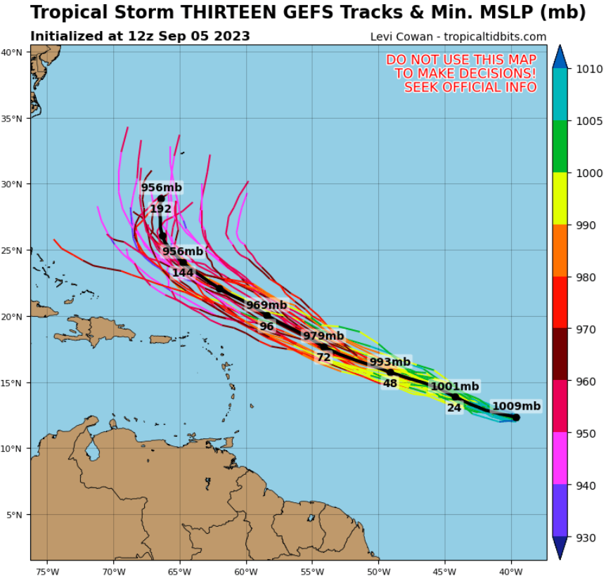
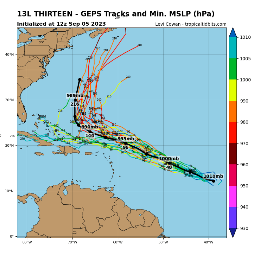
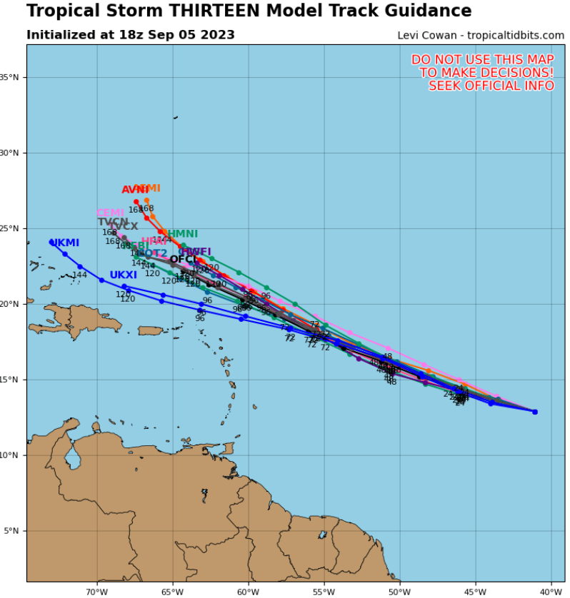
Thankfully, at this time, all the models are pretty consistently predicting it heading just north of the islands as a Major Hurricane.

Attached picture Screenshot 2023-09-05 155640.png
Attached picture Screenshot 2023-09-05 155655.png
Attached picture Screenshot 2023-09-05 155709.png
Posted By: Carol_Hill

Re: Keep an Eye on the Tropics - 09/07/2023 12:56 PM

As of now, looks to be good news for the BVI and USVI. Folks in the Bahamas and (perhaps Florida again????) need to be aware.
Posted By: RatmansWife

Re: Keep an Eye on the Tropics - 09/07/2023 01:17 PM

Wonder if we'll be as lucky with the next one. It's worth watching. We continue to bolster our hurricane defenses, so part of me wants to see how successful those improvements are.
Posted By: Carol_Hill

Re: Keep an Eye on the Tropics - 09/07/2023 01:20 PM

Which "next one"?? If you're talking about the red "x" currently on the NHC website, that one is predicted to steer to the north way before it approaches the islands. Of course at this point, we are basically only about halfway through the season..
Posted By: Kmon

Re: Keep an Eye on the Tropics - 09/07/2023 03:57 PM

Another low pressure area is supposed to come off of Africa in a few days. Some are saying this one will go on a similar path as Lee has done
Posted By: gracet03

Re: Keep an Eye on the Tropics - 09/11/2023 03:20 PM

Oh i see wind is from the West.
What was sailing like with a reversed Wind direction , when the wind is from the WEST.
( caused by LEE circulation.) If one does a trip would you plan a clockwise trip instead of a counterclockwise ?

(if there is any sailing?)
Posted By: duckfat

Re: Keep an Eye on the Tropics - 09/11/2023 03:42 PM

Originally Posted by gracet03
Oh i see wind is from the West.
What was sailing like with a reversed Wind direction , when the wind is from the WEST.
( caused by LEE circulation.) If one does a trip would you plan a clockwise trip instead of a counterclockwise ?

(if there is any sailing?)


Westerly winds rarely hold for more than a couple of days.
Posted By: GeorgeC1

Re: Keep an Eye on the Tropics - 09/11/2023 04:55 PM

I am more concerned about how much sand Lee strips off the N facing beaches.
Posted By: duckfat

Re: Keep an Eye on the Tropics - 09/11/2023 06:31 PM

Originally Posted by GeorgeC1
I am more concerned about how much sand Lee strips off the N facing beaches.

I have a camera on the beach in front of our house on Anegada. So far, the seas have been less than forecast, and have no effect on the beach at all. The northerly wind is bringing us a lot of sargassum, though.
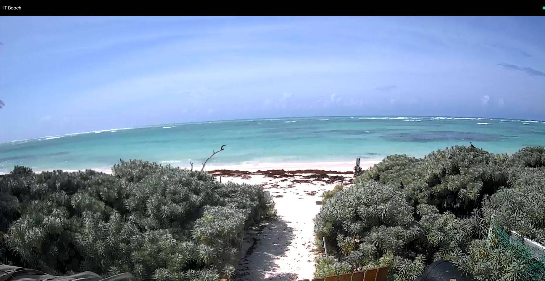
Attached picture Capture.JPG
Posted By: GeorgeC1

Re: Keep an Eye on the Tropics - 09/12/2023 02:53 PM

Surf is up in CDB today. Pretty rough in White Bay with a wrap around surge.
Posted By: LocalSailor

Re: Keep an Eye on the Tropics - 09/13/2023 12:02 AM

https://www.ndbc.noaa.gov/show_plot...uom=E&time_diff=0&time_label=GMT

buoy N. of PR
Posted By: Matt W

Re: Keep an Eye on the Tropics - 09/20/2023 05:44 PM

Here's the next one to watch. NHC has a 70% chance of development moving towards the Leewards. Euro and GFS are split on intensity.

Attached picture Untitled design (22).png
© 2024 TravelTalkOnline