TravelTalkOnline

Close Call

Posted By: enzosxm

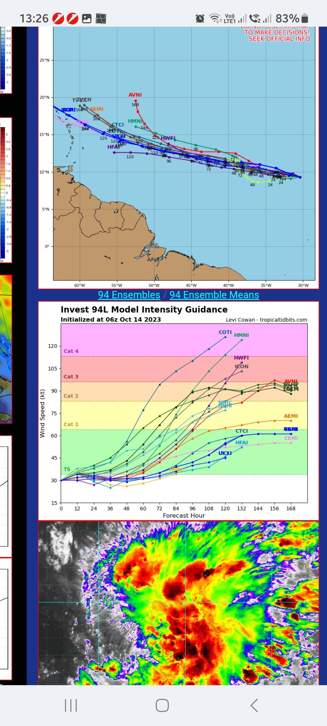
Close Call - 10/14/2023 11:29 AM

This might result in a close call

Attached picture Screenshot_20231014_132647_Samsung Internet.jpg
Posted By: SXMScubaman

Re: Close Call - 10/14/2023 03:55 PM

This the one?
https://www.thedailyherald.sx/regio...ydQBVjIy9u0xK_wxs0TsWQevu8nOHOuTqYKgjWSQ
Posted By: sxmmartini

Re: Sean & 94L - 10/14/2023 05:07 PM

Crap…

https://twitter.com/pppapin/status/1713221156130697410
Posted By: enzosxm

Re: Sean & 94L - 10/14/2023 06:19 PM

Sxmmartini keep enjoying a few more.....
Posted By: Colour1

Re: Sean & 94L - 10/15/2023 08:09 AM

WOW this might be to close for comfort!! We are there this week! Keep you posted.
Posted By: Zanshin

Re: Close Call - 10/15/2023 09:25 AM

The hurricane forecast models (15 Oct, 2023) currently show little chance of this becoming a major issue for St. Martin. The HMNI model is usually pretty good, though; but the bifurcation point to the other models is sometime tomorrow and then it will become apparent which of the models is closest to this weather pattern. In addition, the only model that has this come close to hurricane force shows it going far north. All of the other models show a maximum of low- to mid-intensity tropical storm force winds.
[Linked Image]
Posted By: sxmmartini

Re: Close Call - 10/15/2023 12:13 PM

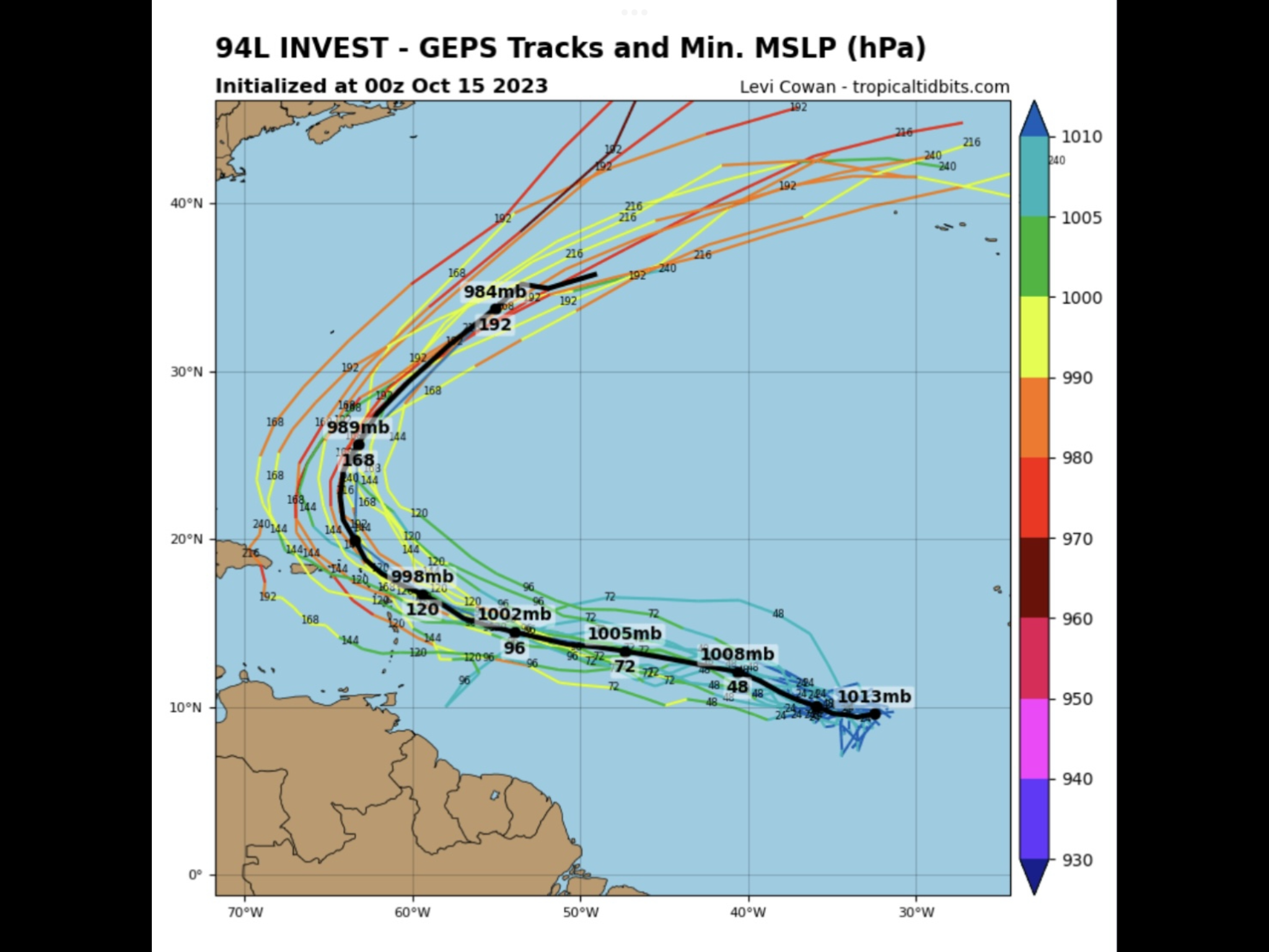
Sean which has been downgraded to 19L is not the system I am monitoring. It is the system behind 19L that has me worried.
It will brush SXM on or before Saturday.

Attached picture IMG_0649.png
Posted By: MIDiver

Re: Close Call - 10/15/2023 05:21 PM

Originally Posted by sxmmartini
Sean which has been downgraded to 19L is not the system I am monitoring. It is the system behind 19L that has me worried.
It will brush SXM on or before Saturday.


Agree. Watching 94L closely. Hopefully it will tug North a bit earlier. Fingers crossed.
© 2024 TravelTalkOnline