US and Spanish Virgin Islands sailing trip
January 26, 2010
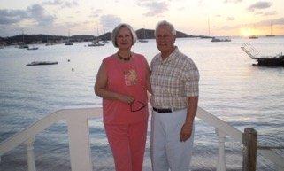
Nolan North
Do you know the difference between a fairy tale and a sailing story? A fairy tale starts with� �once upon a time�. A sailing story starts with� �so there we were.�
So there we were, at the very end of a 10 day charter, leaving Crown Bay Marina with the CYOA charter base in sight through Haulover Cut about 200 yards away, when the US Coast Guard decided that I needed a random, routine inspection. After asking some rather interesting questions and inspecting all the boat�s paperwork, PFDs, fire extinguishers, holding tanks, etc. � let�s just say I didn�t end up in the brig. But it was an interesting way to end a trip!
Contraband? Who, me?
This was an annual sailing trip for (mostly) members of the Downtown Sailing Center, Baltimore, MD. And who could ask for a better crew than this?
What a crew!!!!!!!!
We chose CYOA Yacht Charters on St. Thomas because we intended to go to the �Spanish� Virgin Islands of Culebra and Vieques, and then St. John. Their base on St. Thomas made this ideal. We had two Lavezzi 40� catamarans. After satisfying CYOA that we had two people on each boat qualified to act as captain, that we had the proper charts and the briefer�s sixth-sense that we knew what we were doing (very reasonable requirements of CYOA) we were approved for the SVI�s.
Working with CYOA was easy and they were always friendly and helpful. They pushed their provisioning service, which we rejected mostly due to price, but when we did ask them to provide bulk stuff (water, soda, beer) they couldn�t source Carib or Red Stripe! We did all the rest of the provisioning very successfully at the local Pueblo, including liquor, wine, etc. During the briefings we asked for the boat �decal� information they said they would have for clearing into Puerto Rico (which �owns� the Spanish Virgin Islands). It turned out they had not done that and the briefer told us we were on our own. HOWEVER, before we could clear the docks the staff had made the phone calls to PR and gotten the decal information for each boat � THAT was good service! The boat briefing was very thorough and the chart briefing was OK. A CYOA staff member departed the docks with us and monitored us raising sails, tacking, etc., (and provided helpful hints) then was picked up and sent us own our way. I would definitely use CYOA again and recommend them to others.
Our plan for the first afternoon was to sail out to Buck Island for some snorkeling and then back to Honeymoon Bay for the first night. One of the boats made Buck and had some snorkeling. My boat just enjoyed an extended sail south of Charlotte Amalie and then back to Honeymoon Bay. We found that bay to be overflowing with anchored boats so we went around-the-corner to Lindbergh Bay. This is a very pretty, wide open bay between the two Best Western hotels and right next to the airport. The airport noise abated in the evening only to be replaced by, evidently, local dragsters exercising their horsepower and non-existent mufflers somewhere near the airport. There was also continual noise from the industrial facilities immediately east of Lindbergh. In the future I would think about going on to Brewers Bay, a nice little cove on the north side of the airport�s west end.
Lindbergh Bay
We departed Lindbergh Bay straight south past Porpoise Rock to R2, then turned for Salt Rock as a waypoint to our destination of Ensenada Honda, Culebra. At this time, and for the next several days, the wind was 15-25 mph from a few points either north or south of east and waves from 8-12 feet. So during that time we reduced sail and/or used one sail or the other, depending. We had established a final waypoint at VI0022 (Chart Kit, Virgin Islands and Puerto Rico, Seventh Edition) which would keep us well south of the many coral reefs on the east and south sides of Culebra (the other boat didn�t quite follow that route!). From that waypoint all the marks were in sight and the entrance to Ensenada Honda was easy and straight forward � however, the range marks were of no help. With many boats at anchor we motored around Cayo Pirata and ended up anchoring between the south end of that island and the �creek�. Wanting to do some snorkeling we piled into the dink and took the long ride back to Ensenada Dakity, as it is supposed to have good snorkeling (and probably does, somewhere.) Suffice to say we certainly did not find it and had a very disappointed long ride back to the boat. However, we later dinked to the dock (�dinked to the dock� � that sounds like a title for a Jimmy Buffet song!) at Mamacito�s, in the creek, and had a great dinner.
Mamacito�s
The next day we departed Culebra through the same channel and headed almost due south for the east end of Vieques. We still had one reef in the main, rolled up the genoa to the first reef �point� and had a lively port tack beam reach (when sailing anything from a beam reach or more we used a dock line to rig a barber-hauler from the middle cleat around the genoa sheet to pull the lead further outboard. With the very narrow sheeting angle on all catamarans that really helps performance and stabilizes the sail.). With Puerto Ferro as our destination we carried on south of the east end of Vieques to about 18.05.00 N. At that point we did a �chicken jibe� by heading up, taking in all sails, falling off and pulling out the genny for a starboard run and headed west along that line, to stay well south of the rocks and reefs. While we were doing that jibe we observed the beginnings of a waterspout trying to dive down from the clouds. Our other boat was behind us, pretty much underneath the waterspout, and it certainly did get their attention! The waypoint of 18.05.40 N and 65.24.70 W (per �A Cruising Guide to Puerto Rico including the Spanish Virgin Islands�, Stephen J. Pavlidis, 2003) put us right at the entrance to Puerto Ferro. It is also identified by an old square lighthouse just west of the entrance. Until you have the entrance in sight it looks like one solid limestone cliff, then you will see the break in the cliff. We carried over 6� through the entrance and anchored in 12� right in the middle of the very pretty harbor. Our two boats were the only ones in the harbor! There is good snorkeling along the east side of the harbor entrance.
Warning for unexploded ammo, Vieques!
The plan had been to enjoy the bioluminescent bays of Ferro and Mosquito but the good new, bad news was that this was exactly a full moon. And, of course, no clouds. We couldn�t see anything but the moon rays on the surface! This was very unfortunate as this had been anticipated as one of the highlights of the trip. Our own fault, of course, as we did understand the effect of a full moon on viewing the bioluminescence, but we still hoped it would work out.
On our way back to the USVI we had wanted to stop at Isla Culebrita but knew with the wind and waves it would be untenable. So, we decided to try Cayo de Luis Pena instead. After powering to the east end of Vieques we again shortened sail and had a broad reach, in seas up to 12�, to Luis Pena. That island has very pretty harbors and beaches, particularly one on the north end, some with a ball or two. But the waves were breaking heavy on the beaches and much too rolly to stay. We went on to Bahia Tamarindo, on Culebra, and picked up a ball. The best snorkeling of the whole trip was on the rocks at the north end of this little bay! Our other boat anchored in Bahia de Sardinas and had another night ashore.
Bahia Tamarindo
Another time I would plan to spend a full week in the SVIs. There is plenty to do on the water, under the water and onshore. Particularly with the heavy weather we felt like we had some rather strenuous sailing with too little to show for it. Go for a week and enjoy!
Then came the trip we had been thinking about (dreading?) � 20 miles against the wind and waves back to St. Thomas.
Hold on!
Our first plan was to go around the north side of Culebra to get a better angle for STT, but in the morning the wind had come SSE at 20-24 mph so that would have been right on the nose. So, we went around the south end of Culebra and carried on close hauled to about 18.10.00 N where we tacked back, we thought, for STT. However, with the waves pushing us westward and, I suspect, a fair amount of leeway in these boats, the starboard tack did not even take us as far east as Salt Island, let alone St. Thomas! Discouraged at our lack of progress we then motored the rest of the way for a VERY wet and bumpy ride. Needing water and ice, we ducked into Crown Bay Marina (and refueled as well) then, after calling and getting permission from CYOA, picked up one of their moorings for the night. The other boat had lost an engine so this gave the CYOA mechanics an easy place to solve that problem. Several of us walked over for dinner at Oceana which was very nice (it is a white tablecloth kind of place but we did not feel out of place in our sailing duds.)
The next morning the CYOA staff did some fixing on little stuff (if you consider a constant leak onto your bedding as little stuff) and, of course, the engine cut-off on the other boat. Then we departed for the north shore of St. John. Given the wind conditions we powered all the way. This was my first time through Current Cut and it was a learning experience. When approaching from the south it looks like the west side of Current Rock is wider, the ferries were barreling through and there is a string of visible rocks extending southeast from the Rock. However, on closer inspection we realized the west side looked pretty shallow and, after going around that string of rocks, the east side is open, deep and straight forward � but narrow. We went on to Francis Bay. It took us a few minutes to figure out that Cinnamon, Maho and Francis are all within a few hundred yards of each other.
Where are we?
There were MANY balls available and we picked one all the way north and near the beach as we wanted to snorkel Whistling Cay. It turned out that snorkeling was only fair. With some shopping in order, we headed for the �store� that is here (somewhere!) We first went to Francis � no store. Then to Maho � no store. It turns out there is a small beach in between Francis and Maho � and the store is there, up 100 steps.
We then went on to Leinster Bay � big mistake! It was like a harbor in BVI (one of the reasons we are not too keen on BVI sailing) with all the balls full at noon and we were one of several boats circling around and around waiting for a ball. Finally got one about an hour later (had dropped off the snorkelers at Waterlemon Cay while we circled.) Meanwhile, several of the other boats simply dropped a hook right next to the mooring field � clearly within the anchoring exclusion area for the Park, and the Ranger just motored right by them. In the future we will just stay at Francis/Maho. That harbor is just as pretty, the snorkeling is just as good, there are plenty of balls and the hiking to the ruins is just a little longer (isn�t that a good thing?)
Coming out of Leinster we met up with a Lagoon 410 and a Lagoon 500 coming past Little Thatch Island and going up the SFD Channel. We had been coming to the conclusion that the Lavezzi 40 is a good sailing boat but we couldn�t prove it until up �against� a couple other boats. So there we were, all three with one reef and full genoa close hauled with plenty of breeze. Neither of the Lagoons could come close to pointing with us and even when they were laying off could not match our speed. Take that Lagoon! (However, remember, �Man invented the slowest form of transportation, sailboats, then decided to race them.�)
We broke off the �race� and went around to Coral Harbor. It is hard to imagine a more straight-forward harbor entrance and after wandering around among the many anchored boats we ended up anchoring almost back at the entrance markers (small, hard to find, locally maintained � and probably irrelevant.) This place is a �blast from the past�. The cruising guide describes Coral Harbor as ��home to some wonderfully eccentric and dedicated cruising sorts.� Or, it might be where old hippies, and their boats, go to die. Witness half a dozen boat relics permanently in the mangroves and many seemingly uninhabited boats at anchor � looking like they are just awaiting their turn to be washed ashore.
We headed in for lunch and were rather surprised to find NO DINGY DOCK. They just run lines out from shore and anchor the other end, you tie up to it and wade ashore over slippery rocks (tricky going back out with parcels.) We did have a very pleasant lunch at the Aqua Bistro, adequate provisioning at the adjacent market and shopping for goodies in the upstairs boutiques (all in the prominent orange building.) Note: I bought three bottles of top shelf liquor at that market, to take home in my checked luggage, and they were cheaper than the Duty Free at SST. That evening some of the crew decided they needed to experience Skinny Legs. They reported reasonable pub-grub/burgers for dinner and a very interesting local scene! They thought they were in a time warp when the hippies started playing Wii bowling. I was glad not everyone went ashore as we had a significant wind shift and our other boat started dragging right toward another boat. We hailed them and they avoided a collision and re-anchored.
The next day started with a short trip to Little Lamshur for snorkeling. It, and Great Lamshur, are very nice, pretty, rarely used harbors with great beaches. Little Lamshur had about 6 balls and Great Lamshur looked like it had more. The snorkeling was good along the east side of the cove. We noticed a red ball near the entrance which probably signals better snorkeling and it was reported that the rocks in front of the abandoned building were good. I would definitely come back here and hang out, just a great spot.
Little Lamshur
With Christmas Cove as our destination for this last night we found, as opposed to the earlier part of the trip!, no wind to get us there. So, we powered along the south coast of St. John and anchored next to our other boat in the Cove. After letting the anchor get well settled, putting on the bridle and backing down hard I thought we were home. About an hour later, while looking over the top of a dark-and-stormy, I noticed all the other boats were in a different position � or wait, maybe I was in a different position. Yep, on the last night the old skipper was dragging anchor (hmmm, that sounds like another good title for a Jimmy Buffet song.)
Dark and Stormy
While this was nearing the end of one adventure, it turned out to be only the beginning of another. That night we learned (by the way, there was cell phone coverage for this entire trip) that a huge snow storm (turned out to be one of the biggest ever) in the mid-Atlantic area had closed airports in Baltimore and DC. So, we all started scrambling to get rebooked. Most of us had been booked to fly home on Friday. The first to arrive home was very late Sunday night, most of us made it on Monday and one, poor thing �stuck� on St. Thomas (and the only one flying AA), got home the following Saturday!
The last morning, with still no wind, we motored back to Crown Bay Marina for fuel. So there we were, at the very end of a 10 day charter, leaving Crown Bay Marina with the CYOA charter base in sight� avast there - that is where we started all this!